Veröffentlichung

4 posts

Neuerscheinung: Recalibrating the Quantitative Revolution in Geography

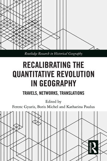
Gyuris, Ferenc; Michel, Boris; Paulus, Katharina (Hg.) (2022): Recalibrating the Quantitative Revolution in Geography. Travels, Networks, Translations. London: Routledge.

This book brings together international research on the quantitative revolution in geography. It offers perspectives from a wide range of contexts and national traditions that decenter the Anglo-centric discussions. The mid-20th-century quantitative revolution is frequently regarded as a decisive moment in the history of geography, transforming it into a modern and applied spatial science. This book highlights the different temporalities and spatialities of local geographies laying the ground for a global history of a specific mode of geographical thought. It contributes to the contemporary discussions around the geographies and mobilities of knowledge, notions of worlding, linguistic privilege, decolonizing and internationalizing of geographic knowledge.

This book will be of interest to researchers, postgraduates and advance students in geography and those interested in the spatial sciences.
https://www.routledge.com/Recalibrating-the-Quantitative-Revolution-in-Geography-Travels-Networks/Gyuris-Michel-Paulus/p/book/9780367640866

Neuerscheinung: “Digital In Situ Data Collection in Earth Observation, Monitoring and Agriculture”

Teucher, Mike, Detlef Thürkow, Philipp Alb, and Christopher Conrad. 2022. “Digital In Situ Data Collection in Earth Observation, Monitoring and Agriculture—Progress towards Digital Agriculture” Remote Sensing 14, no. 2: 393. https://doi.org/10.3390/rs14020393

Digital solutions in agricultural management promote food security and support the sustainable use of resources. As a result, remote sensing (RS) can be seen as an innovation for the fast generation of reliable information for agricultural management. Near real-time processed RS data can be used as a tool for decision making on multiple scales, from subplot to the global level. This high potential is not yet fully applied, due to often limited access to ground truth information, which is crucial for the development of transferable applications and acceptance. In this study we present a digital workflow for the acquisition, processing and dissemination of agroecological information based on proprietary and open-source software tools with state-of-the-art web-mapping technologies. Data is processed in near real-time and thus can be used as ground truth information to enhance quality and performance of RS-based products. Data is disseminated by easy-to-understand visualizations and download functionalities for specific application levels to serve specific user needs. It thus can increase expert knowledge and can be used for decision support at the same time. The fully digital workflow underpins the great potential to facilitate quality enhancement of future RS products in the context of precision agriculture by safeguarding data quality. The generated FAIR (findable, accessible, interoperable, reusable) datasets can be used to strengthen the relationship between scientists, initiatives and stakeholders.

Volltext verfügbar als HTML und PDF.

New Publication: “Digital In Situ Data Collection in Earth Observation, Monitoring and Agriculture”

Teucher, Mike, Detlef Thürkow, Philipp Alb, and Christopher Conrad. 2022. “Digital In Situ Data Collection in Earth Observation, Monitoring and Agriculture—Progress towards Digital Agriculture” Remote Sensing 14, no. 2: 393. https://doi.org/10.3390/rs14020393

Digital solutions in agricultural management promote food security and support the sustainable use of resources. As a result, remote sensing (RS) can be seen as an innovation for the fast generation of reliable information for agricultural management. Near real-time processed RS data can be used as a tool for decision making on multiple scales, from subplot to the global level. This high potential is not yet fully applied, due to often limited access to ground truth information, which is crucial for the development of transferable applications and acceptance. In this study we present a digital workflow for the acquisition, processing and dissemination of agroecological information based on proprietary and open-source software tools with state-of-the-art web-mapping technologies. Data is processed in near real-time and thus can be used as ground truth information to enhance quality and performance of RS-based products. Data is disseminated by easy-to-understand visualizations and download functionalities for specific application levels to serve specific user needs. It thus can increase expert knowledge and can be used for decision support at the same time. The fully digital workflow underpins the great potential to facilitate quality enhancement of future RS products in the context of precision agriculture by safeguarding data quality. The generated FAIR (findable, accessible, interoperable, reusable) datasets can be used to strengthen the relationship between scientists, initiatives and stakeholders.

Full-Text available as HTML and PDF.

Neuerscheinung: Handbuch Kritisches Kartieren von Finn Dammann und Boris Michel

Karten erzählen Geschichten und formen unser räumliches Verständnis von Welt. Sowohl das Lesen als auch das Erstellen von Karten bedeutet, die Welt auf eine bestimmte Weise zu erzeugen, zu beschreiben und wahrzunehmen. Dahingehend hinterfragen kritische Kartograph*innen die Macht der Karte und eignen sich die Praxis der Kartographie an.

In über 20 Beiträgen stellen die Beiträger*innen des Handbuchs Kritisches Kartieren neue Methoden und theoretische Zugänge für kritische Kartierungen sozialer Wirklichkeiten vor und diskutieren Möglichkeiten einer anderen Kartographie für Forschung, Lehre und Aktivismus.

https://www.transcript-verlag.de/978-3-8376-5958-0/handbuch-kritisches-kartieren/